
What Route 1 Actually Is
Iceland's Route 1, commonly called the Ring Road, is a single paved highway that loops around the entire island — roughly 1,332 kilometers in total. Completed in 1974, it connects almost every major region of Iceland and passes through terrain that shifts from mossy lava fields to glacial outwash plains to steep fjord-carved valleys, sometimes within a single hour of driving.
What surprises many first-time visitors is how unevenly distributed the dramatic scenery is. The southern coast packs iconic sights within short distances, while large stretches of the north and east are long, quiet, and genuinely remote. Road quality also varies significantly: most of the route is two-lane asphalt, but several segments in the east and northeast involve gravel, narrow bridges, and sudden weather changes that can make conditions challenging, particularly outside summer months.
Planning any segment of the Ring Road requires honest self-assessment about driving experience, vehicle type, and time of year. Renting a standard two-wheel-drive sedan is adequate for most of the route in summer, but highland detours branching off Route 1 are a different matter entirely and require four-wheel-drive vehicles by law in Iceland.
Region-by-Region Breakdown
Reykjavik to Vík (South Coast)
This is the most trafficked segment, and for good reason. The road runs between the ocean and a wall of volcanic peaks, passing Seljalandsfoss and Skógafoss waterfalls, the Eyjafjallajökull glacier, and the black sand beaches near Vík. The road itself is wide and well-maintained. Distances between attractions are short, which means this stretch can feel busy, particularly in summer. Expect parking lots at popular stops to fill early in the day.
Vík to Höfn (Southeast)
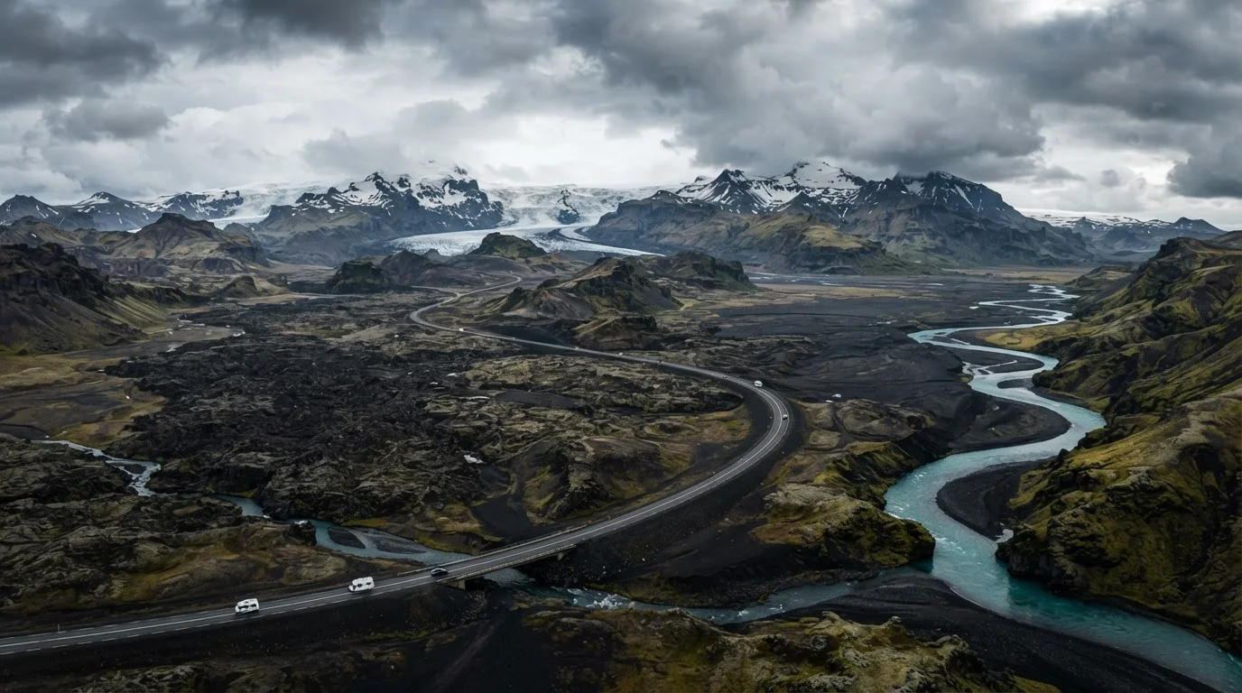
East of Vík, the road crosses Skeiðarársandur — a vast glacial outwash plain that stretches for miles with almost nothing on it. The Vatnajökull glacier dominates the landscape, and Jökulsárlón glacial lagoon sits directly beside the road. This is one of the most visually arresting segments. Road conditions are generally good, but the sandur is notorious for fierce crosswinds that can catch high-sided vehicles hard.
Höfn to Egilsstaðir (East Fjords)
This segment takes the road into the East Fjords, where Route 1 winds through a series of narrow fjords on roads that hug steep hillsides above the water. The scenery is quieter and more intimate than the south. Be aware that this stretch includes some of the Route's narrowest passages and a handful of one-lane tunnels, some of which require paying a toll.
Fuel Stations Are Sparse in the Northeast
Between Egilsstaðir and Mývatn, the distances between fuel stations can exceed 100 kilometers in some segments. It is strongly advisable to fill your tank completely at every opportunity rather than waiting until the gauge drops. This region also has fewer accommodation options, so advance booking is more important here than on the more-touristed southern stretch.
Egilsstaðir to Mývatn (Northeast)
Crossing into the northeast, the landscape becomes stark and volcanic. The area around Mývatn is geologically active — mud pools, lava formations, and steam vents are visible from or near the road. This is one of the least-visited regions, and services like fuel stations are spaced further apart. Filling up whenever possible is practical advice, not overcaution.
Mývatn to Akureyri and the North
Akureyri is Iceland's second-largest city and a genuine rest point. The road west from here curves along fjords toward the Snæfellsnes Peninsula turnoff and eventually back toward Reykjavik. The northern interior can experience heavy snow well into May and again from October, so route conditions here are among the most seasonally dependent on the entire circuit.
Practical Realities Before You Drive
The Ring Road is not a highway in the American interstate sense. Speed limits outside urban areas are 90 km/h on paved roads and 80 km/h on gravel — and enforcement by speed cameras is active throughout. Icelandic weather is genuinely unpredictable; a sunny morning can turn into near-whiteout conditions in under an hour. The Icelandic Road and Coastal Administration maintains a website and app (road.is) where travelers can check road conditions and closures by route number before departing each day.
Sheep are a real road hazard from roughly June through September, as they graze unfenced across Iceland. They tend to dart unpredictably. Driving at dusk or dawn in those months requires heightened attention.
Travelers should also verify current entry requirements, local driving regulations, and any seasonal road closures with official Icelandic authorities and their own country's government travel advisories before departure, as conditions and rules can change.
Sandur
A broad, flat glacial outwash plain formed by glacial meltwater depositing sediment. Iceland's sandurs, particularly Skeiðarársandur, are among the largest in the world and are known for fierce wind exposure.
Jökulhlaup
A sudden glacial outburst flood caused by volcanic activity or pressure beneath a glacier. These events have historically reshaped roads and bridges in southern Iceland.
Vatnajökull
Europe's largest glacier by volume, located in southeastern Iceland. Several outlet glaciers from Vatnajökull are visible directly from Route 1.
F-Road
Designated highland interior roads in Iceland that are legally restricted to four-wheel-drive vehicles. F-roads branch off Route 1 but are not part of the Ring Road itself.
Midnight Sun
A natural phenomenon in Iceland during summer months where daylight persists for most or all of the 24-hour period, significantly affecting driving fatigue and planning.